Description
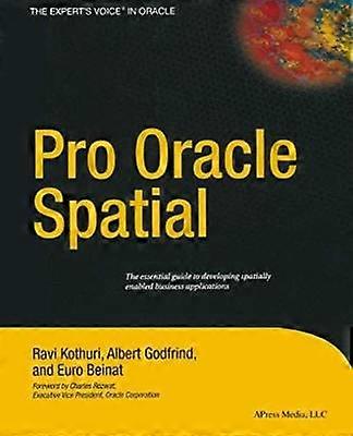
Pro Oracle Spatial
1 Overview. - 1 Spatial Information Management. - 2 Overview of Oracle Spatial. - 3 Location-Enabling Your Applications. - 2 Basic Spatial. - 4 The SDO_GEOMETRY Data Type. - 5 Loading Transporting and Validating Spatial Data. - 6 Geocoding. - 7 Manipulating SDO_GEOMETRY in Application Programs. - 3 Analysis and Visualization. - 8 Spatial Indexes and Operators. - 9 Geometry Processing Functions. - 10 Network Modeling. - 11 Generating Maps Using MapViewer. - 12 A Sample Application. - 4 Advanced Spatial. - 13 Case Studies. - 14 Tips Common Mistakes and Common Errors. - Appendix A Additional Spatial Analysis Functions. - Tiling-Based Analysis. - TILED_BINS. - TILED_AGGREGATES. - Neighborhood Analysis. - AGGREGATES_FOR_GEOMETRY. - AGGREGATES_FOR_LAYER. - Clustering Analysis. - SPATIAL_CLUSTERS. - Refining the Candidates for Site Selection. - Geometry Simplification for Speeding Up Analysis. - Summary. - Appendix B Linear Referencing. - Concepts and Definitions. - Measure. - Linear Referenced Segments. - Direction. - Shape Points. - Offset. - Typical Application. - Creating Linear Referenced Geometries. - SDO_GTYPE in LRS Geometries. - Constructing LRS Geometries. - Metadata. - Spatial Indexes and Spatial Operators on LRS Geometries. - Dynamic Segmentation Operations. - Clip a Segment. - Locate a Point. - Project a Point. - Validation of LRS Segments. - Dynamic Segmentation on 3D Geometries. - Other Operations. - Summary. - Appendix C Topology Data Model in Oracle. - Topology Data Model. - Benefits of the Topology Data Model. - Storing a Topology Data Model in Oracle. - Operating on a Topology in Oracle. - Creating a Topology. - Associating a Feature Layer with a Topology. - Inserting Updating and Populating Feature Layers. - Updating Topological Elements. - Querying for Topological Relationships. - Hierarchical Feature Model. -Summary. - Appendix D Storing Raster Data in Oracle. - SDO_GEORASTER Data Type. - Storage for SDO_GEORASTER Data. - Metadata in SDO_GEORASTER Data. - Populating SDO_GEORASTER Columns. - Manipulating Raster Objects. - Generating Pyramids. - Subsetting. - Georeferencing. - Visualizing Raster Data in Oracle MapViewer. - Summary. Language: English
-
Brand:
Unbranded
-
Category:
Computing & Internet
-
Artist:
Ravikanth Kothuri
-
Format:
Paperback
-
Language:
English
-
Publication Date:
2013/05/28
-
Publisher / Label:
Apress
-
Number of Pages:
712
-
Fruugo ID:
337819012-741477562
-
ISBN:
9781430253051
Delivery & Returns
Dispatched within 4 days
Shipping from United Kingdom.
We do our best to ensure that the products that you order are delivered to you in full and according to your specifications. However, should you receive an incomplete order, or items different from the ones you ordered, or there is some other reason why you are not satisfied with the order, you may return the order, or any products included in the order, and receive a full refund for the items. View full return policy

